


LIBERTY, Grant County, Indiana
About
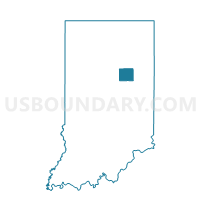
Outline

Summary
| Unique Area Identifier | 577339 |
| Name | LIBERTY |
| County | Grant County |
| State | Indiana |
| Area (square miles) | 42.18 |
| Land Area (square miles) | 42.18 |
| Water Area (square miles) | 0.01 |
| % of Land Area | 99.98 |
| % of Water Area | 0.02 |
| Latitude of the Internal Point | 40.42971980 |
| Longtitude of the Internal Point | -85.73913790 |
Maps


Graphs
Select a template below for downloading or customizing gragh for LIBERTY, Grant County, Indiana


Neighbors
Neighoring Voting District (by Name) Neighboring Voting District on the Map
- AIRPORT 02 (LIBERTY TWP) (NV), Grant County, IN
- AIRPORT 03 (FRANKLIN TWP) (NV), Grant County, IN
- BOONE 01, Madison County, IN
- DUCK CREEK 1, Madison County, IN
- FAIRMOUNT 04, Grant County, IN
- FRANKLIN 04, Grant County, IN
- FRANKLIN 05, Grant County, IN
- GREEN, Grant County, IN
- MILL 05, Grant County, IN
- SIMS, Grant County, IN
Top 10 Neighboring County Subdivision (by Population) Neighboring County Subdivision on the Map
- Mill township, Grant County, IN (10,882)
- Franklin township, Grant County, IN (7,211)
- Fairmount township, Grant County, IN (4,239)
- Sims township, Grant County, IN (1,779)
- Liberty township, Grant County, IN (1,028)
- Boone township, Madison County, IN (661)
- Duck Creek township, Madison County, IN (548)
- Green township, Grant County, IN (500)
Top 10 Neighboring Place (by Population) Neighboring Place on the Map
Top 10 Neighboring Unified School District (by Population) Neighboring Unified School District on the Map
- Marion Community Schools, IN (36,849)
- Mississinewa Community School Corporation, IN (10,882)
- Madison-Grant United School Corporation, IN (8,645)
- Oak Hill United School Corporation, IN (7,796)
Top 10 Neighboring State Legislative District Lower Chamber (by Population) Neighboring State Legislative District Lower Chamber on the Map
- State House District 32, IN (63,192)
- State House District 35, IN (62,848)
- State House District 31, IN (55,677)
Top 10 Neighboring State Legislative District Upper Chamber (by Population) Neighboring State Legislative District Upper Chamber on the Map
Top 10 Neighboring 111th Congressional District (by Population) Neighboring 111th Congressional District on the Map
Top 10 Neighboring Census Tract (by Population) Neighboring Census Tract on the Map
- Census Tract 102, Grant County, IN (4,370)
- Census Tract 103, Grant County, IN (4,190)
- Census Tract 104, Grant County, IN (3,260)
- Census Tract 101, Madison County, IN (3,070)
Top 10 Neighboring 5-Digit ZIP Code Tabulation Area (by Population) Neighboring 5-Digit ZIP Code Tabulation Area on the Map
- 46953, IN (24,177)
- 46036, IN (11,663)
- 46928, IN (4,951)
- 46938, IN (3,200)
- 46070, IN (2,351)
- 46986, IN (1,915)